We can't get up there yet to see how bad it is, but the USFS posted a soil burn damage map of the fire at http://inciweb.org/incident/2324/.
I overlayed it onto a mapquest map of Miller, Carr and Nicksville, and marked our launches and LZ and the Carr Canyon road. Both launches were involved, as was the LZ and most of the road to launch. Since there have been a couple of heavy rainfalls since the fire we may have some roadwork to do.
<img src="/album_pic.php?pic_id=830" border="0" vspace="10" alt="Miller Canyon burn map" title="Miller Canyon burn map">
The Coronado NF website says the scheduled reopening date is August 20th (http://www.fs.fed.us/r3/coronado/).
Miller burn damage map
Moderators:ioan, John Wolfe, aaroncromer, jlowery
-
John Wolfe
- Posts:996
- Joined:Fri Aug 12, 2005 6:08 pm
- Location:Oro Valley (NW Tucson)
Re: Carr Canyon bridge
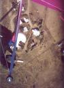
Holy crap, Morey. Where did you get that picture?
Update: Ah, never mind. I see it: http://inciweb.org/incident/photographs/2324/
Update: Ah, never mind. I see it: http://inciweb.org/incident/photographs/2324/